Reef Madness
No more haulout. After Panama City’s strict curfews, limited mobility and lockdowns, I’m ready for a change.
We’re on our way to the Las Perlas archipelago, wind on unmasked faces, zipping through the Gulf of Panama at seven knots.
That haulout was so worth it for our speed. I wish I could haul myself out and get back up to speed so quickly.
I can’t wait to swim again in warm, green salt water; to walk on something not-concrete. The Perlas, named for once-abundant pearls, are full of shellfish, snorkel-friendly fish, game fish, and the birds who eat them.
Not the game fish, although pelicans got game. By the hundreds, they make breathtaking dive after dive. Small hawks, cormorants, and frigates foray high above. Gulls and terns chase beat-up fishing trawlers, competing with pelicans for the catch of the day.
Even if I wasn’t allowed off the boat, I’d come to watch the bird life.

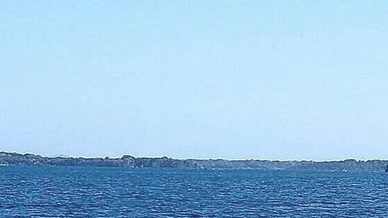
Las Perlas archipelago, Panamá.
Low and Rising
Our destination is Isla Casaya, midway between Contadora’s mansions and the largest island to the south, Isla del Rey. The cruising guide warns sailors often about navigating reefs and rocks. Its author throws in casual mentions of “antifouling-streaked” rocks and “uncharted” reefs or describes beaches as “good for careening.”
The key, he says, is entering on a low, rising tide.
We reach Isla Casaya at high tide and barge on in.
At full high tide the entry doesn’t wrack my nerves, my customary state of mind during a reef approach. I know the hazards are there but can’t see them. SV Hanalei has plenty of water under her freshly-polished keel, thanks to Panama’s impressive tides. We drop anchor in eight well-protected meters and hang up the hammock.
The breeze is fresh air, not boatyard grit. The nearest beeping TraveLift is fifty miles away. Unless you count the odd bird call, it’s utterly silent.
There’s not a light in sight. The stars are brilliant.
It almost feels like cruising before COVID closed so many doors.

Casaya brings a change of scenery, all right. Constantly changing, in fact. An ebbing tide reveals more beach every half hour. A peninsula appears between the shore and an off-lying rock.
By mid-tide, we’re surrounded by reef.
La Mina island at high tide…

… mid tide…

… and low.
It’s not a soft Bahamian sandbar or a Cuban shelf thirty meters below. This is hard, rocky, unrelenting reef, the kind that spoils a brand-new paint job.
I’m getting nervous. What else will show up? Is there enough sand under the anchor? How much sand is enough sand? Apparently, anxiety deserves a shakedown, too.

Tides
How much worse will this get?
I check my phone’s boating app to see what’s happening with the tide. It’s a few days past the full moon so tides are higher and lower than normal.
Lots lower. Low tide is -.39m (-15.2”).
So low.
.39m (15.2”) LOWER than the chart says.
This is how a boat sees that number.

Hanalei aground at -.3 meter tide, Chapera Island, Panama.
As the reef grows, my anxiety heads into absurdity. Is this island actually a mountaintop like the ones stranded by flooding Lake Gatún? Or a volcano?

Now you don’t see the entrance…

… now you do.
The Chief Engineer isn’t worried. Nature isn’t his wheelhouse, equipment is. Navigation is on me.
This ever-changing landscape is new territory. I want a chart from Harry Potter that shows real-time reef.
What constitutes a low, rising tide? How low? How risen?
It leads to the more practical question, how will we get out of here?
Reef madness is the first step. Who knows where it leads?
Fair winds,
Christine
Do Tell
What’s your favorite grounding story?